Map of The Bahamas and Caribbean Region with Geographic Markings
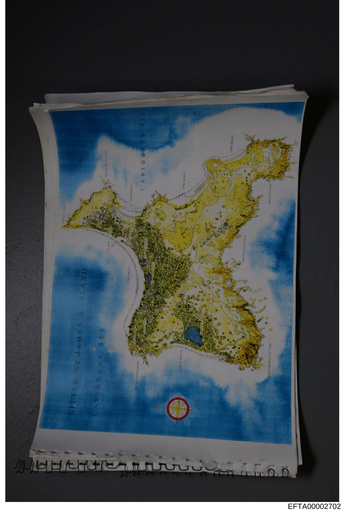
This is a physical map document showing The Bahamas and surrounding Caribbean islands with yellow land masses, blue water, and various geographic labels. The map includes what appears to be investigative markings or annotations, including a red circular symbol in the lower portion. The document appears to be evidence material related to locations of interest in the investigation.
Document Transcript
Photograph of a map showing The Bahamas and Caribbean region. The map displays:
- Land masses colored in yellow/tan - Ocean areas colored in blue - Various island outlines and geographic features marked - Text labels for 'CARIBBEAN' and other geographic markers visible - A red circular symbol with concentric rings positioned in the lower central portion of the map, appearing to mark a specific location - The map appears to be on white/cream colored paper - Multiple pages or sheets are visible in a stack behind the main map - A Bates number (EFTA00002702) visible at bottom of photograph - The map is photographed against a dark background
Frequently Asked Questions
What is "Map of The Bahamas and Caribbean Region with Geographic Markings"?
Where does this document come from?
How long is this document?
Can I download this document?
Type
PhotoSource
DOJ - Data Set 1Release Date
January 24, 2025
Pages
1
File Size
451.8 KB
Format
Data Set
data-set-1
OCR Confidence
ID: EFTA00002702
Last updated: May 3, 2026
Related Documents
View all photosInterior Office Space Photograph with Desk and Computer Equipment
This is a photograph of a modern office interior, showing a workspace with a glass desk, computer equipment, filing systems, and office furniture. ...
Interior Design Photograph: Blue and White Decorated Room with Furniture Display
This is a photograph of an elegantly decorated interior space featuring blue and white color scheme with custom furnishings, wallpaper, curtains, a...
Interior Photo of Commercial Kitchen or Break Room Corridor
This is a photograph of a narrow hallway or corridor leading into a commercial kitchen or break room space. The image shows a black-and-white check...
Bedroom Interior with Blue Walls and Furnishings
This is a photograph of an upscale bedroom interior, likely from one of Jeffrey Epstein's properties, showing luxury furnishings and décor. The ima...
Jeffrey Epstein on Boat in Tropical Waters with Water Sports Equipment
This photograph shows Jeffrey Epstein standing on a boat or dock in clear turquoise water in what appears to be a tropical location. He is wearing ...
Interior photograph of residential hallway and kitchen area
This photograph shows the interior of a residential space, depicting a hallway leading to a kitchen area with white painted doors, wood flooring, a...